×
Log in
Upload File
Most Popular
Art & Photos
Automotive
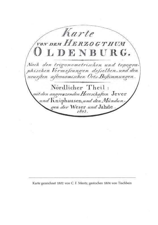
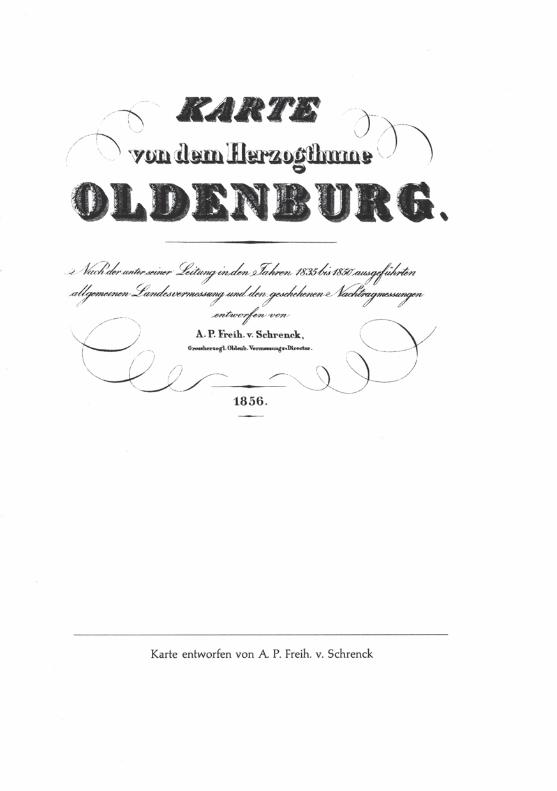
Business
Career
Design
Education
Hi-Tech
+ Browse for More
Download pdf -
Landesamt für Geoinformation und Landesvermessung
Download pdf
Transcript
Page 1
Page 2
Page 3
Page 4
Page 5
Page 6
Page 7
Page 8
Page 9
Page 10
Page 11
Page 12
LOAD MORE
Recommended
ALKIS ® Das Amtliche Liegenschaftskataster-Informationssystem in Brandenburg Landesvermessung und Geobasisinformation Brandenburg Dezernat Strategische
Documents
DVW-Seminar ALKIS – hier und heute 18. Februar 2006 1 Das ALKIS - Konzept der AdV - Einführung Markus Seifert Landesamt für Vermessung und Geoinformation
Documents
Produktkatalog Heft 2 - hvbg. · PDF fileHessisches Landesamt für Bodenmanagement und Geoinformation Historische Topographische Karten Produktkatalog Heft 2 Historische Topographische
Documents
Proseminar Geoinformation II Thomas Artz
Documents
Technisches Regelwerk - thueringen.de · Landesamt für Vermessung und Geoinformation Technisches Regelwerk zur Eignungsfeststellung der eingesetzten Datenverarbeitungs-programme
Documents
Landesvermessung und Geobasisinformation Brandenburg Stefan Wagenknecht Auskünfte, Daten und Dienste
Documents
Bodenrichtwerte im Internet - BORIS Hessen · Gestaltung und Druck. Hessisches Landesamt für Bodenmanagement und Geoinformation, Wiesbaden, 1 / 2011. Bodenrichtwerte. im Internet
Documents
Geoinformation III
Documents
Bereitstellung der Bauleitpläne im Internet - gdi.bayern.de · Landesamt für Vermessung und Geoinformation Geschäftsstelle Geodateninfrastruktur Bayern Bauleitpläne im Internet
Documents
Geoinformation I
Documents
Das Magazin für Geoinformation
Documents
Karten, Geodaten, Luftbilder › export › sites › lgl › unsere-themen › Produkte … · Herausgeber: Landesamt für Geoinformation und Landentwicklung Baden-Württemberg Büchsenstraße
Documents
Landesamt für Geoinformation und Landesvermessung … · vom Blatt Göttingen und 25 weiteren Blättern des südlichen Nieder- sachsens noch eine exakte handgezeichnete Kopie aus
Documents
Geoinformation IV
Documents
Das AAA – Datenmodell der AdV im Überblick - thueringen.de · Landesamt für Vermessung und Geoinformation Frank Engel Dezernatsleiter IT-Entwicklung Geoinformationssysteme
[email protected]
Documents
Geoinformation II Präsentation:Christoph Platen Overlay
Documents
Impressum Landesamt für Vermessung und Geoinformation
Documents
Kundeninformationstag Sandra Rein; Martina Braune Landesvermessung und Geobasisinformation Brandenburg
Documents