Embed Size (px)
Citation preview
E-Mail [email protected]
Weitere Landkarten und Straßenkarten können optional ergänzt werden. Kartenkatalog im Internet: www.digitalelandkarten.de
Service
Free hotline Video tutorials (in German) Online presentations Live support Downloads / Updates / Service Packs EasyMap available in English and German
All maps are delivered with design templates. Thus, the maps are immedia-tely ready for presentations without requiring much additional input.* Maps for specific industries as well as for official statistics as well as thestreet maps are not contained in the standard scope of delivery of the soft-ware. These maps can optionally be purchased as an accessory for EasyMap.
Contact us for more information about additional as well as international map data: [email protected]
Lutum+Tappert DV-Beratung GmbHAm Rheindorfer Ufer 2D-53177 Bonn
Telefon +49 (228) 95 91 40 Fax +49 (228) 95 91 444
E-Mail [email protected]
Attention! Profit from the advantage of purchasing a concurrent user network license: Pay for just one license available to all users!
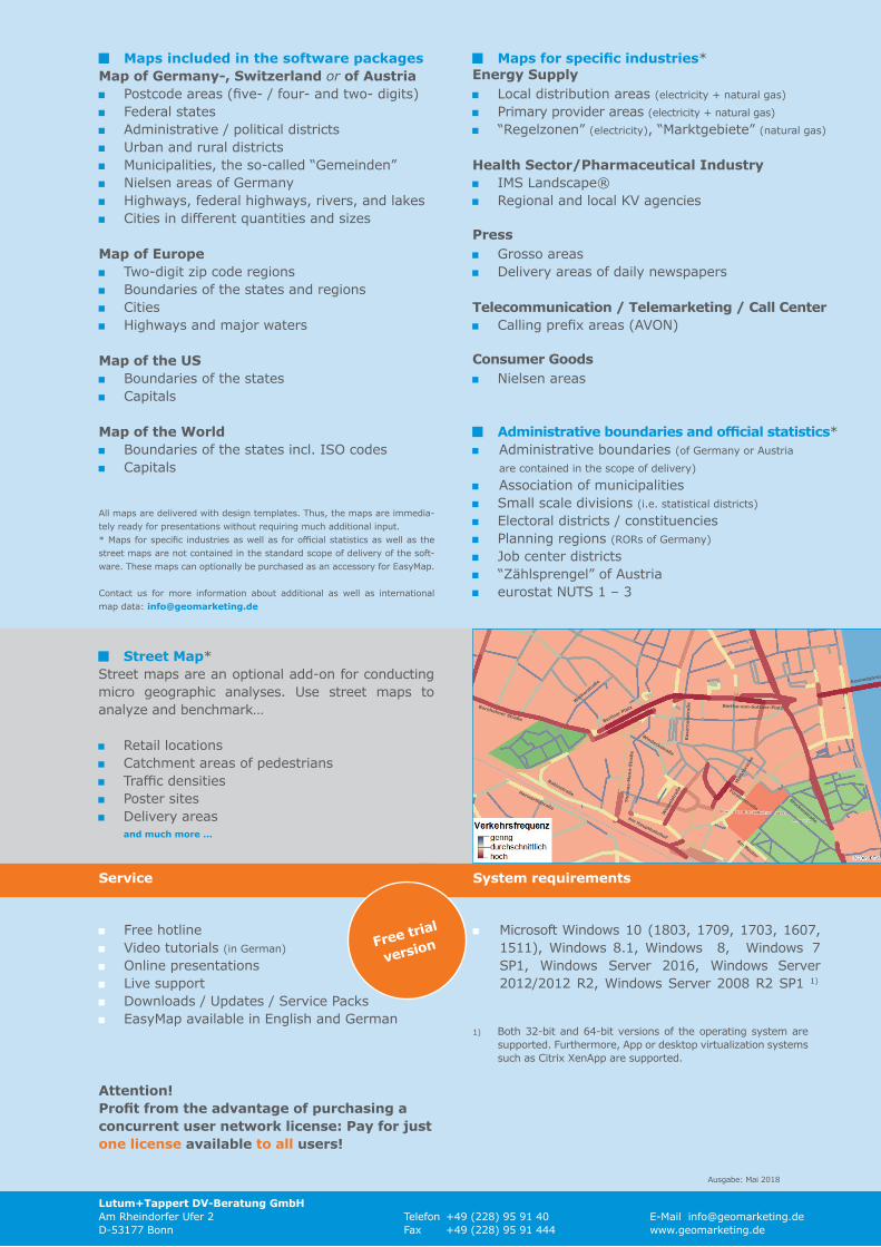
Maps included in the software packages Map of Germany-, Switzerland or of Austria Postcode areas (five- / four- and two- digits) Federal states Administrative / political districts Urban and rural districts Municipalities, the so-called “Gemeinden” Nielsen areas of Germany Highways, federal highways, rivers, and lakes Cities in different quantities and sizes
Map of Europe Two-digit zip code regions Boundaries of the states and regions Cities Highways and major waters
Map of the US Boundaries of the states Capitals
Map of the World Boundaries of the states incl. ISO codes Capitals
Maps for specific industries* Energy Supply Local distribution areas (electricity + natural gas) Primary provider areas (electricity + natural gas) “Regelzonen” (electricity), “Marktgebiete” (natural gas)
Health Sector/Pharmaceutical Industry IMS Landscape® Regional and local KV agencies
Press Grosso areas Delivery areas of daily newspapers
Telecommunication / Telemarketing / Call Center Calling prefix areas (AVON)
Consumer Goods Nielsen areas
Administrative boundaries and official statistics* Administrative boundaries (of Germany or Austria
are contained in the scope of delivery) Association of municipalities Small scale divisions (i.e. statistical districts) Electoral districts / constituencies Planning regions (RORs of Germany) Job center districts “Zählsprengel” of Austria eurostat NUTS 1 – 3
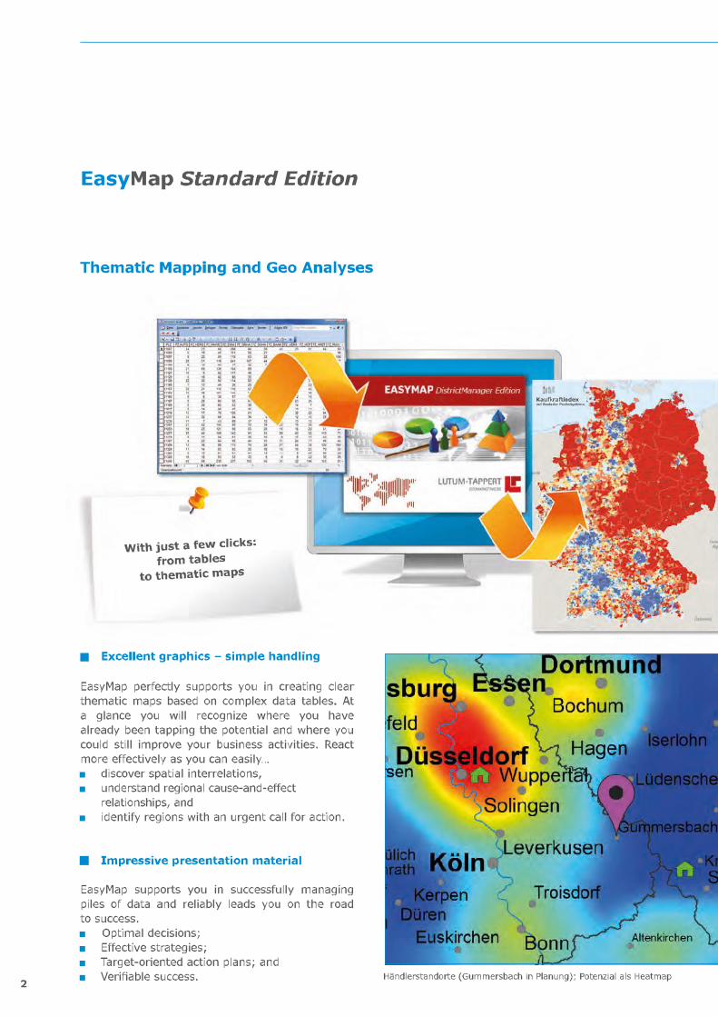
Street Map*Street maps are an optional add-on for conducting micro geographic analyses. Use street maps to analyze and benchmark…
Retail locations Catchment areas of pedestrians Traffic densities Poster sites Delivery areas
and much more ...
Berliner Platz
Wes
sels
traß
e
Weih
erstr
aße Kennedybrüc
Mar
ktbr
ücke
Kas
erne
nstr
aße
Thom
as-M
ann-
Stra
ße
Bertha-von-Suttner-Platz
Am HauptbahnhofAm Neutor
RabinstraßeHerwarthstraße
Windeckstraße
Fürstenstraße
Stockenstraße
Bornheimer Straße
Free trial
version
Ausgabe: Mai 2018
System requirements
Microsoft Windows 10 (1803, 1709, 1703, 1607, 1511), Windows 8.1, Windows 8, Windows 7 SP1, Windows Server 2016, Windows Server 2012/2012 R2, Windows Server 2008 R2 SP1 1)
1) Both 32-bit and 64-bit versions of the operating system aresupported. Furthermore, App or desktop virtualization systemssuch as Citrix XenApp are supported.