Embed Size (px)
Citation preview
M E M O R A N D U M To: Ms. Francine Bromberg
Preservation Archaeologist Alexandria Archaeology 105 N. Union Street, Suite 327 Alexandria, VA 22314
From: Edward W. Johnson, Senior Archeologist, Thunderbird Archeology (WSSI) Tammy Bryant, M.A., R.P.A, Principal Archeologist, Thunderbird Archeology Date: July 29, 2011, Revised June 15, 2012 Re: Letter Report: Archeological Investigations within Landbay L (±47 acres) Potomac Yard Property City of Alexandria, Virginia WSSI #21486.07
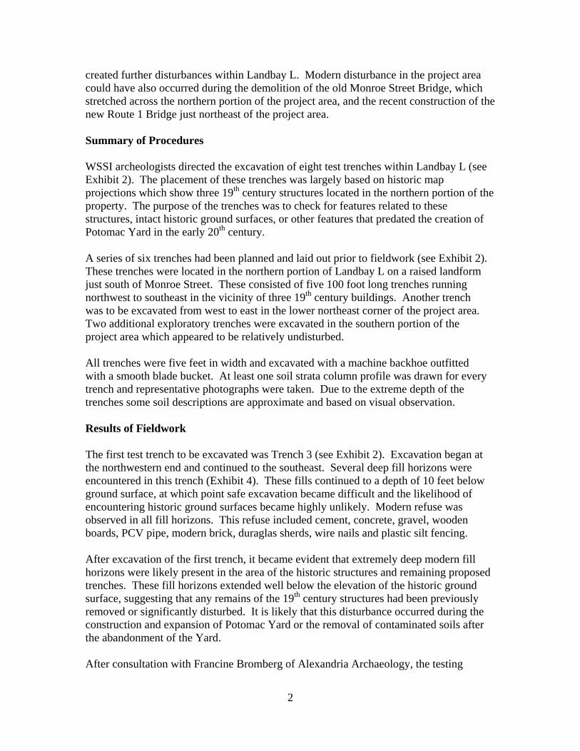
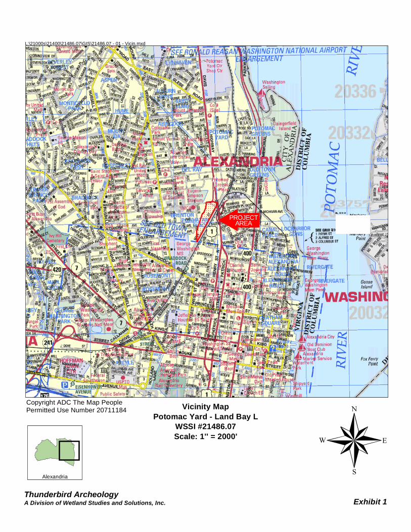
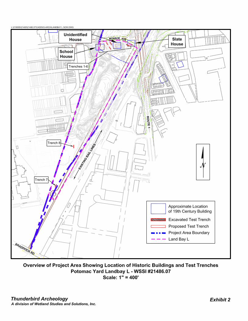
Archeological test-trenching was conducted within Landbay L of Potomac Yard by Thunderbird Archeology, a division of Wetland Studies and Solutions, Inc., of Gainesville, Virginia (Exhibit 1). The work was carried out in July 2011 for Pulte Home Corporation of Fairfax, Virginia, following a February 17, 2011 Scope of Work approved by Francine Bromberg of Alexandria Archeology (Appendix I). The primary objective of this work was to locate potential remains of three historic buildings which are depicted on the 1878 and 1894 Hopkins maps along the historic alignment of Monroe Avenue (which forms the northern boundary of Landbay L). The buildings are identified as the circa 1873 Alexandria Schoolhouse (Ruffner School No. 2), an unnamed building and the residence of John and Mary Robertson (Slate House). Exhibit 2 shows the location of these resources. The historic ground surface, based on an 1865 contour map, is approximately the same grade as the current elevation within Landbay L, although the construction of Potomac Yard between circa 1904 and 1906 significantly altered the landscape (Exhibit 3). In addition to the construction of tracks and railroad-related buildings within the project area, the establishment of Potomac Yard led to the demolition of the existing structures along Monroe Street, the re-alignment of the Alexandria Turnpike (Route 1), and the construction of bridge to carry Monroe Avenue over Potomac Yard. The dismantling of Potomac Yard in the late 20th century and the recent infrastructure improvements (including the realignment of Route 1 and Monroe Street) have likely
2
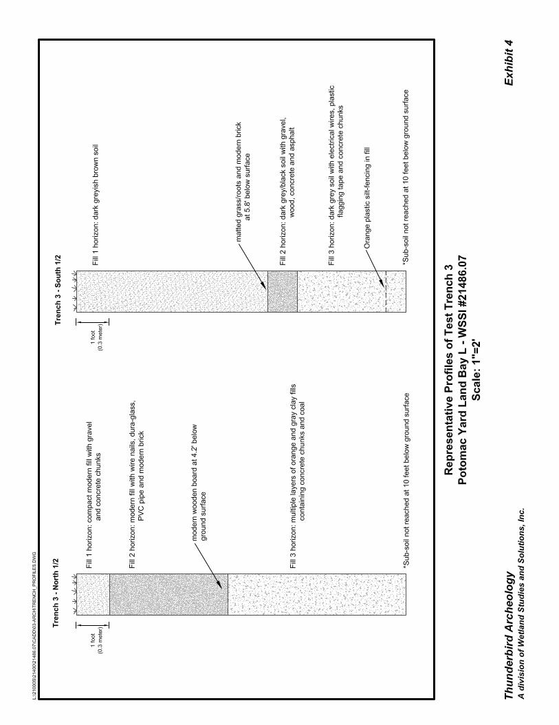
created further disturbances within Landbay L. Modern disturbance in the project area could have also occurred during the demolition of the old Monroe Street Bridge, which stretched across the northern portion of the project area, and the recent construction of the new Route 1 Bridge just northeast of the project area. Summary of Procedures WSSI archeologists directed the excavation of eight test trenches within Landbay L (see Exhibit 2). The placement of these trenches was largely based on historic map projections which show three 19th century structures located in the northern portion of the property. The purpose of the trenches was to check for features related to these structures, intact historic ground surfaces, or other features that predated the creation of Potomac Yard in the early 20th century. A series of six trenches had been planned and laid out prior to fieldwork (see Exhibit 2). These trenches were located in the northern portion of Landbay L on a raised landform just south of Monroe Street. These consisted of five 100 foot long trenches running northwest to southeast in the vicinity of three 19th century buildings. Another trench was to be excavated from west to east in the lower northeast corner of the project area. Two additional exploratory trenches were excavated in the southern portion of the project area which appeared to be relatively undisturbed. All trenches were five feet in width and excavated with a machine backhoe outfitted with a smooth blade bucket. At least one soil strata column profile was drawn for every trench and representative photographs were taken. Due to the extreme depth of the trenches some soil descriptions are approximate and based on visual observation. Results of Fieldwork The first test trench to be excavated was Trench 3 (see Exhibit 2). Excavation began at the northwestern end and continued to the southeast. Several deep fill horizons were encountered in this trench (Exhibit 4). These fills continued to a depth of 10 feet below ground surface, at which point safe excavation became difficult and the likelihood of encountering historic ground surfaces became highly unlikely. Modern refuse was observed in all fill horizons. This refuse included cement, concrete, gravel, wooden boards, PCV pipe, modern brick, duraglas sherds, wire nails and plastic silt fencing. After excavation of the first trench, it became evident that extremely deep modern fill horizons were likely present in the area of the historic structures and remaining proposed trenches. These fill horizons extended well below the elevation of the historic ground surface, suggesting that any remains of the 19th century structures had been previously removed or significantly disturbed. It is likely that this disturbance occurred during the construction and expansion of Potomac Yard or the removal of contaminated soils after the abandonment of the Yard. After consultation with Francine Bromberg of Alexandria Archaeology, the testing

3
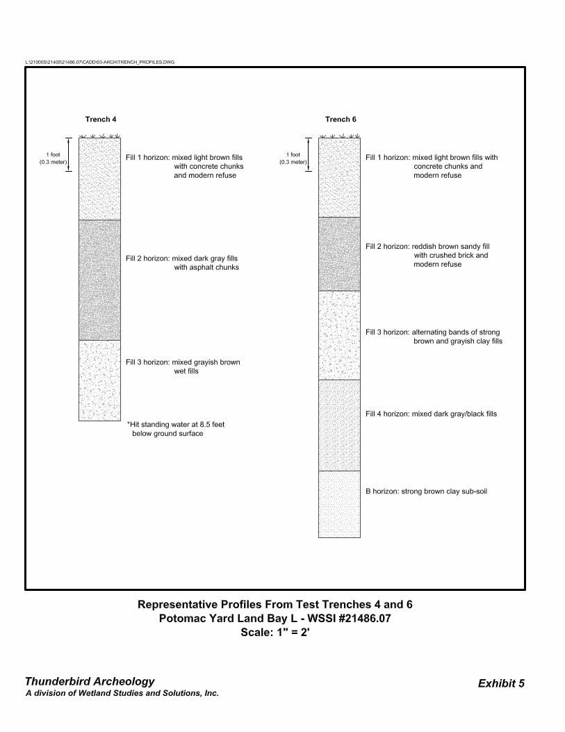
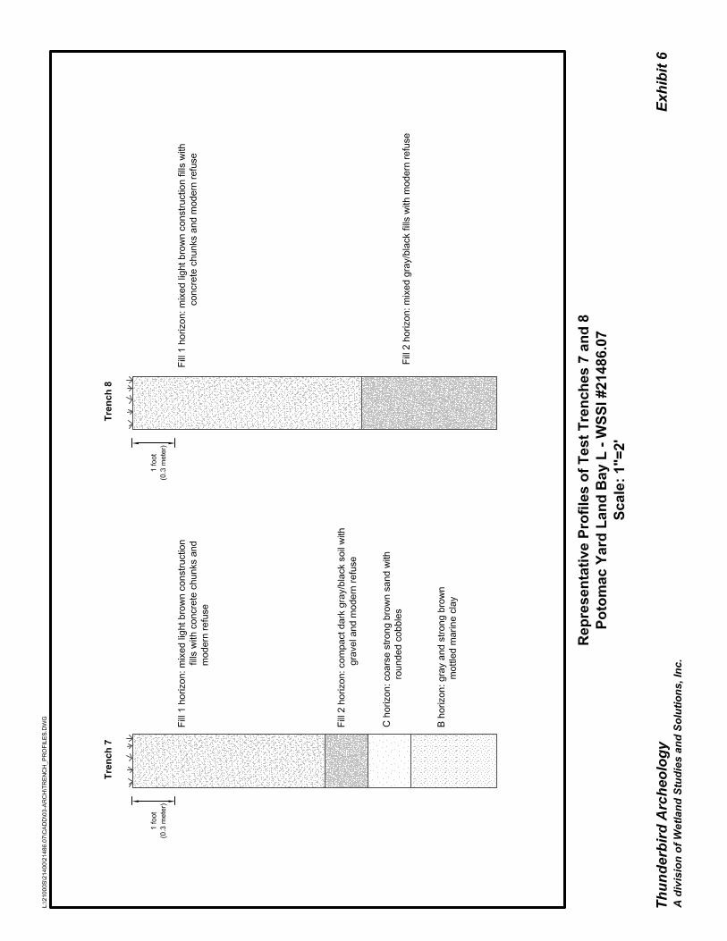
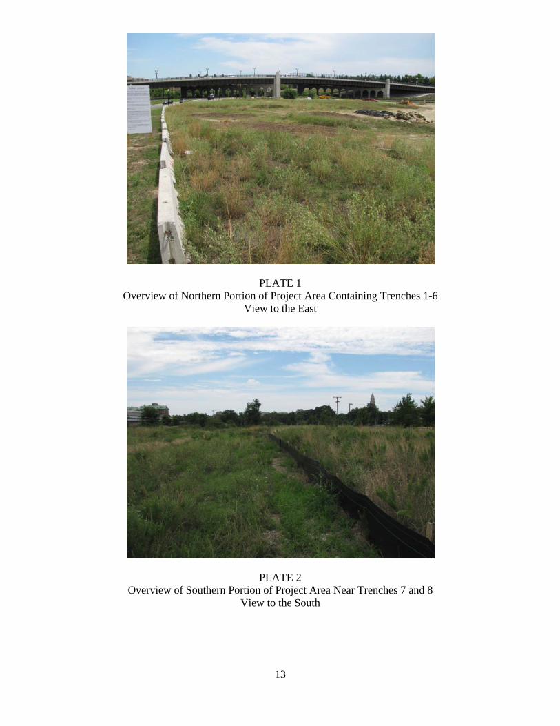
strategy was altered to only excavate the ends of a portion of the planned trenches to confirm the presence of deep modern fill horizons. If such fill horizons were present, the remaining portion of each trench would not be excavated. It was also decided that excavation below 10 feet would not be necessary and that a toothed backhoe bucked could be used in order to expedite the deep excavation through compacted fill horizons. The remaining trenches confirmed that deep modern fill horizons are present throughout the project area, and any remains of historic structures have been removed or significantly disturbed. A worker on-site during the archeological excavation claimed that much of the remaining original soil had been removed in recent years due to contamination related to the railway activities in Potomac Yard during the 20th century. This claim is supported by the presence of modern refuse encountered in some of the deepest portions of the test trenches. Representative profiles of these trenches can be seen in Exhibits 4 through 6. Representative photos of each test trench and overview photos of the project area are also included below. Summary A series of eight test trenches were excavated within Landbay L of Potomac Yard in July of 2011 by Thunderbird Archeology, a division of Wetland Studies and Solutions, Inc. These trenches were excavated in order to locate potential remains of three structures shown on historic maps from the late 19th century. Excavation of the test trenches revealed that deep modern fill horizons are present in the areas where these structures stood, as well as in the remaining portion of Landbay L. No evidence of historic ground surfaces or features were observed and no further archeological work is recommended.
PROJECTAREA
Thunderbird Archeology
Vicinity MapPotomac Yard - Land Bay L
WSSI #21486.07Scale: 1'' = 2000'
Exhibit 1
L:\21000s\21400\21486.07\GIS\21486.07 - 01 - Vicin.mxd
®Copyright ADC The Map PeoplePermitted Use Number 20711184
A Division of Wetland Studies and Solutions, Inc.
Alexandria

10

11
PLATES

12
13
PLATE 1 Overview of Northern Portion of Project Area Containing Trenches 1-6
View to the East
PLATE 2 Overview of Southern Portion of Project Area Near Trenches 7 and 8
View to the South

14
15
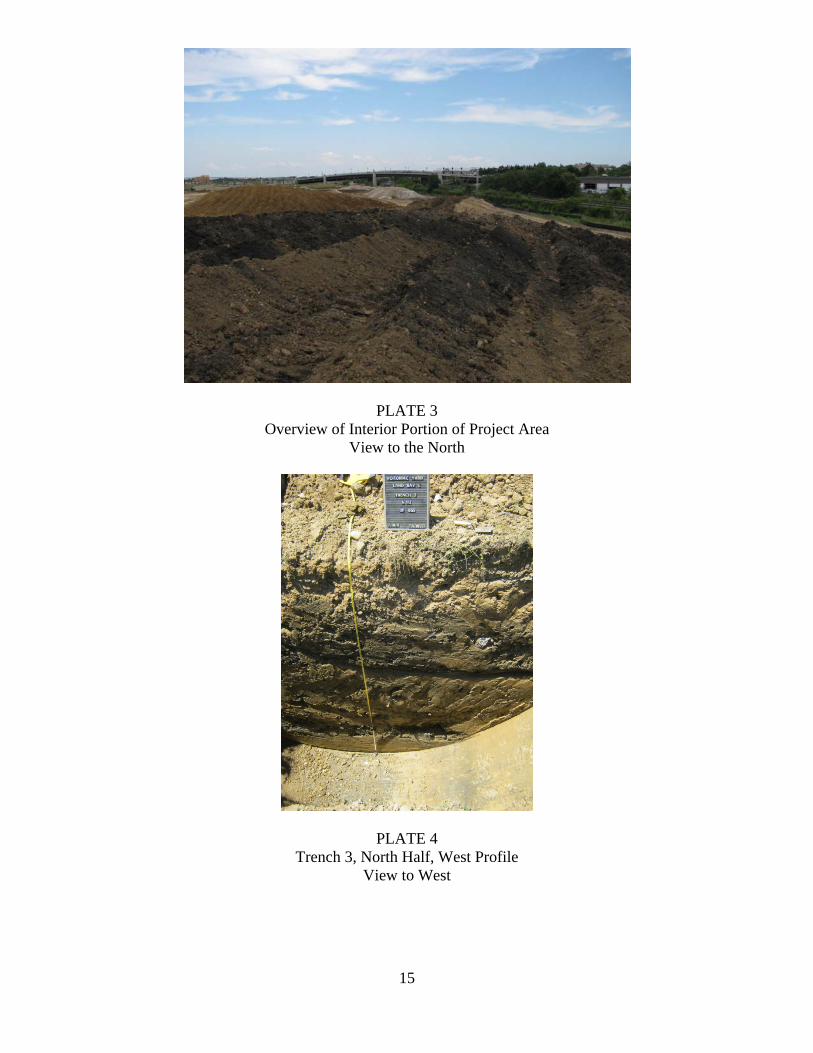
PLATE 3 Overview of Interior Portion of Project Area
View to the North
PLATE 4 Trench 3, North Half, West Profile
View to West

16
17
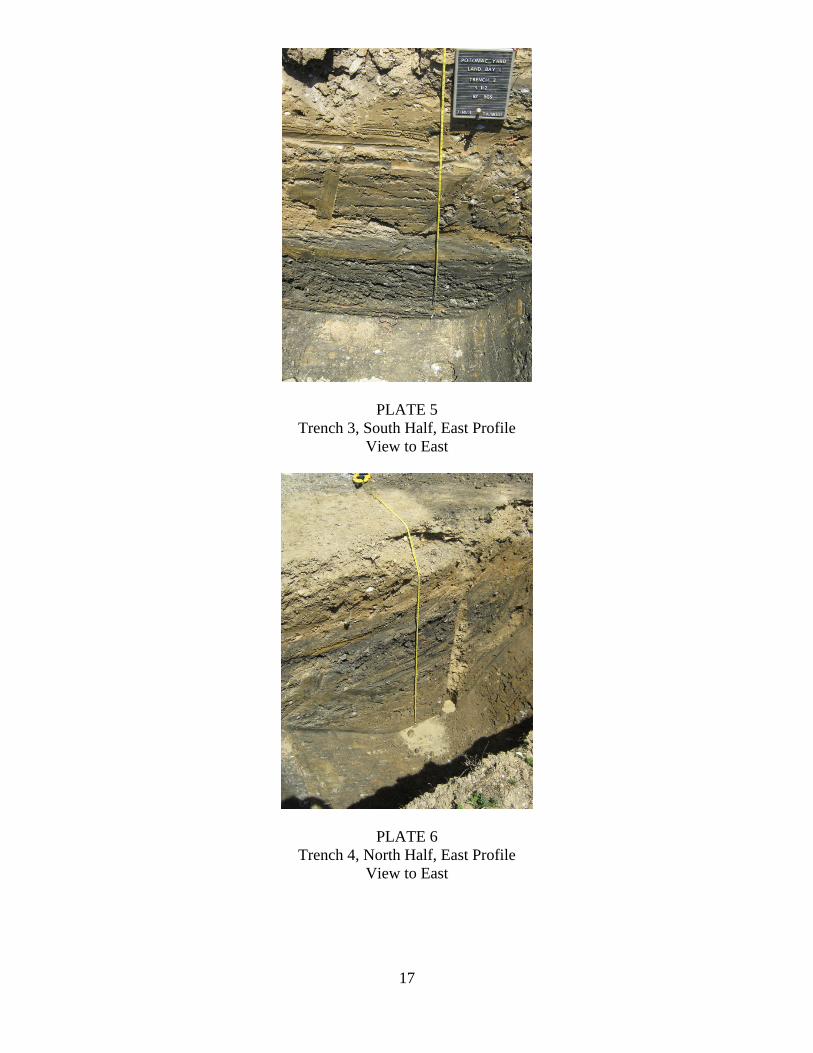
PLATE 5 Trench 3, South Half, East Profile
View to East
PLATE 6 Trench 4, North Half, East Profile
View to East

18
19
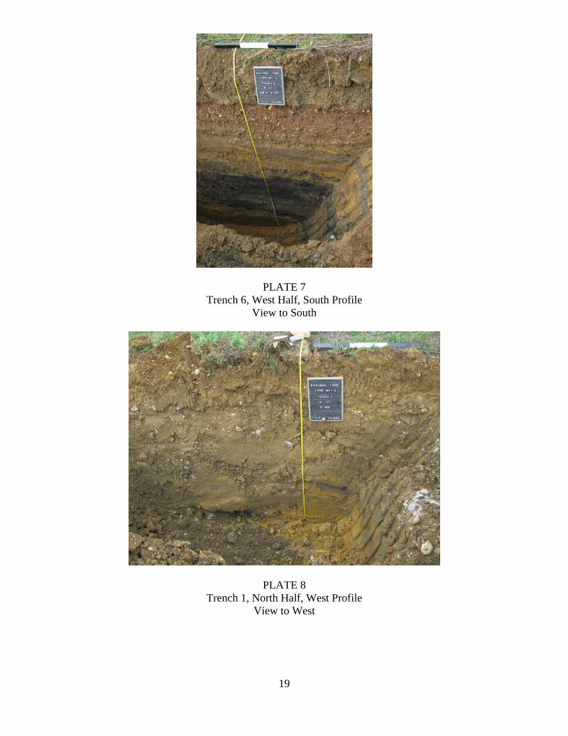
PLATE 7 Trench 6, West Half, South Profile
View to South
PLATE 8 Trench 1, North Half, West Profile
View to West

20
21
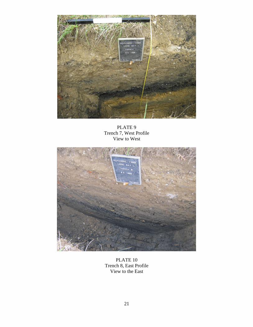
PLATE 9 Trench 7, West Profile
View to West
PLATE 10 Trench 8, East Profile
View to the East

22

23
Appendix I Scope of Work

24
25
Scope of Work for Archeological Investigations within
Landbay L, Potomac Yard City of Alexandria, Virginia
February 17, 2011
Introduction This Scope of Work is based upon a January 20, 2011 onsite meeting and follow up discussions in February, with Francine Bromberg of Alexandria Archaeology. The goal of the Scope of Work is to locate any potential significant archeological resources within the northwestern portion of Landbay L (Exhibit 1). All aspects of this investigation will adhere to OSHA regulations and comply with the City of Alexandria Archaeological Standards, the Guidelines for Conducting Cultural Resource Survey in Virginia, and the Secretary of the Interior’s Standards and Guidelines for Archaeology and Historic Preservation. If significant archeological resources are located, archeological test excavations will be required. A separate Scope of Work shall be written for any additional work. Background Three historic buildings are depicted on the 1878 and 1894 Hopkins maps along the historic alignment of Monroe Avenue (which forms the northern boundary of Landbay L). The buildings are identified as a ca. 1873 Alexandria Schoolhouse (Ruffner School No. 2), an unnamed building and the residence of John and Mary Robertson (Slater House). The construction of Potomac Yard between circa 1904 and 1906 significantly altered the landscape. In addition to covering the project area with tracks and railroad-related buildings, the establishment of Potomac Yard led to the demolition of the existing structures along Monroe Street, the re-alignment of the Alexandria Turnpike (Route 1), and the construction of bridge to carry Monroe Avenue over Potomac Yard. The dismantling of Potomac Yard in the late 20th century and the recent infrastructure improvements (including the realignment of Route 1 and Monroe Street) have likely created further disturbances within Landbay L. The historic ground surface, based on an 1865 contour map, is approximately the same grade as the current elevation within Landbay L. As the historic ground surface is not expected to be deeply buried, geotechnical boring is not required. Rather, archeological testing will consist of backhoe trenching.
26
Archaeological Trenching The archeological investigations will primarily focus on the northern end of Landbay L and will consist of excavating six exploratory backhoe trenches of varying length (generally 100 feet) across the projected location of the Ruffner School House, the unidentified dwelling, and the Slate House (see Exhibit 1). The location of the six trenches was established in consultation with Francine Bromberg of Alexandria Archaeology; however field conditions (including buried utilities) may dictate the location and length of these trenches. All trenches will be four-five feet in width and will be excavated with a machine backhoe outfitted with a smooth blade bucket. The purpose of these trenches will be to locate intact ground surfaces and features. At least one soil strata column profile will be drawn for every trench. Photographs will be taken. Trenches will be back filled after recordation of the soil profiles if features/buried surfaces are not located. In trenches where features occur, the excavations will be expanded if necessary to allow for safe hand excavation and evaluation. If the event that features or pre-1906 ground surfaces are encountered, additional work will be needed to access the significance of the findings. Decisions regarding the significance of features and the need for additional testing will be made in consultation with Alexandria Archaeology. The features discovered during this process will be drawn and photographed and if deemed necessary, excavated. The additional work may involve a combination of trench expansion and hand excavation of 5 x 5 foot square test units. The trench expansion may involve stripping of larger area to expose significant features. The additional work will be billed to the client on a per test unit basis. Refer to the Test Unit Excavations section below. The cost proposal does not include the excavation of any "deep shaft" features, i.e. wells or privies, which may be encountered. Depending on the size and nature of these features, this may be added as an additional service. In addition, the archaeological will excavate with a machine backhoe, up to 20 small “test pit” trenches across the remainder of the Landbay in areas to be determined in the field, in order to explore the presence/absence of intact cultural horizons. Test Unit Excavations: If warranted, test units (5 x 5 feet) will be excavated as part of this scope to test potentially significant archaeological features and buried ground surfaces. The test units will be excavated stratigraphically and all soil will be screened through 1/4-inch mesh hardware cloth screens. Soil profiles will be made of representative units, with soil colors described using the Munsell Soil Color Chart designations. Artifacts will be bagged and labeled by unit number and by soil horizon. The work will be documented with field notes, sketch plans, photographs, and slides. Any features encountered will be mapped and made available for inspection by Alexandria Archaeology. Since it is not known if the test units will be necessary, they will be budgeted on a per-unit basis.
27
Laboratory Work and Curation Archaeological artifacts recovered from the project area will be cleaned, stabilized (if necessary), cataloged, labeled and packaged in accordance with the guidelines set forth in the City of Alexandria Archaeological Standards. Organic materials that may require conservation may be recovered; however, the cost proposal will not include conservation services, which may be added as an additional service, if required. At the conclusion of the project, all original photographs, negatives, slides, digital images, videotapes, copies of historical documents, field notes and forms (original copy and a duplicate copy), other field records, as well as the artifacts if they are to be donated to the City, will be delivered to Alexandria Archaeology. Archaeological collections recovered as a result of the Alexandria Archaeology Resource Protection Code must be curated at a facility which meets Federal standards for archaeological curation and collections management as described by 36CFR Part 79. The Alexandria Archaeology Storage Facility meets these standards, and the property owner is encouraged to donate the artifact collection to the City for curation. The archaeological consultant is responsible for arranging for the donation of the artifacts with the owner and will deliver the artifacts and signed forms to the appropriate storage facility. Archaeological Evaluation Report The Archaeological Evaluation Report will include the following: a map of the project area; a map with unit locations and significant features; a summary of the procedures; results of the field investigation and artifact analysis, including a distribution map or other graphics which indicate potentially significant archaeological areas; an integration of the field and analysis data with the historical record. If the investigation results in the discovery of features that require additional archaeological work, the Archaeological Evaluation Report will include a Resource Management Plan. The Resource Management Plan will present a strategy, scope of work (including a map indicating locations of proposed work in relation to completed tests), and budget for further investigations. All archaeological sites discovered will be registered with the Virginia Department of Historic Resources and copies of the registration forms will be submitted to Alexandria Archaeology. When the fieldwork is completed, two copies of the full Archaeological Evaluation Report will be submitted to Alexandria Archaeology as a draft for review. Once the report is approved by the City Archaeologist, revisions will be made, and four copies of it, one unbound with original graphics, will be submitted to Alexandria Archaeology. The report will also be submitted on a CD. All site maps and drawings must be inked or computer-generated so as to produce sharp and clear images that will result in clear photocopies.
28
The City of Alexandria Archaeological Standards require that a public summary be prepared as part of an Archaeological Evaluation Report. The public summary will be approximately 4 to 8 pages long with a few color illustrations. This should be prepared in a style and format that is reproducible for public distribution and use on the City’s web site. Examples of these can be seen on the Alexandria Archaeology Museum website. A draft of the summary should be submitted to Alexandria Archaeology for review along with the draft of the Archaeological Evaluation Report. Upon approval, a master copy (hard copy as well as on CD or computer disk) will be submitted to Alexandria Archaeology. The summary and graphics should also be e-mailed to Alexandria Archaeology for publication on our web site. Tasks The following is a summary of the tasks to be completed:
1. Obtain the appropriate City permits, Miss Utility clearance, and notify Alexandria Archaeology of the field work start date.
2. Complete the field investigation. Alexandria Archaeology staff may conduct site
inspections throughout the course of the field work.
3. Produce and submit two draft copies of the Archaeological Evaluation Report to Alexandria Archaeology. If further archaeological investigations are necessary, the evaluation report can be a letter report to accompany the Resource Management Plan; the final report can be produced after all field work is completed.
4. Make required revisions, and deliver to Alexandria Archaeology four copies of
the final report and one digital version of the report on a CD, plus all field notes, photographs, slides, and associated records. In addition, arrange for the donation and delivery of the artifacts to an appropriate storage facility. Alexandria Archaeology is the preferred repository and requires a City of Alexandria Deed of Gift form.
Formats for Digital Deliverables: 1. Photographs: .jpg. 2. Line Drawings: .gif or .jpg as appropriate. 3. Final Report/Public Summary Word, PageMaker and/or PDF 4. Other Written material: Word, Access, Excel, PageMaker or PDF as
appropriate L:\Proposals\proposals\2011\Potomac Yard - Landbay L\SOW Landbay L.doc